Plastic Landmine Detection Research
Cofounder and Chief Scientist of Safe Pro AI
Cofounder and President of the Demining Research Community

Spatial and temporal variability of the 2018 Kīlauea Lower East Rift Zone Fissure 8 lava flow
Coauthors:
Einat Lev, Janine Birnbaum, Brenna A Halverson, Hannah R Dietterich, Alan G Whittington, Julia E Hammer, Edward W Llewellin
The 2018 Kilauea Lower East Rift Zone (KLERZ) eruption was the most voluminous eruption on the island of Hawai’i in the past 200 years, emplacing 1.4 km3 of lava that destroyed over 700 buildings. The majority of the KLERZ effusion concentrated at the Ahuʻailāʻau fissure, which persisted for over two months. To examine the variability of flow dynamics and lava properties over space and time we use particle image velocimetry to extract lava velocity from 211 syn-eruptive videos captured by uncrewed aerial vehicles above the lava flow. We find that the distance from the vent and underlying slope were the primary controls on flow velocity with time after caldera collapse as the dominant temporal factor. Our data follows the relation between velocity Vmax and distance from the vent D such that Vmax =gh2D , where h is flow depth, and (D) is lava density. This relation closely resembles Jeffreys equation, suggesting that the viscosity increases linearly with distance from the vent up to 12 km. This inference matches previous estimates that the lava’s effective viscosity increased at a rate of ~730 Pa s / km in the first 2 km away from the vent, which we discuss in the context of textural evolution of the lava. Temporally, the Ahuʻailāʻau lava flow velocities were dominated by 24-48 hour surge cycles induced by caldera collapse events at Hale’maumau crater. Each cycle begins with a steep acceleration phase that reaches a maximum volumetric flux ~3-4 hours after the caldera collapse, followed by a longer deceleration phase lasting over 40 hours. We model the surges as a pressure diffusion problem, gaining insight into the physical properties of the magma within the East Rift Zone plumbing system. We demonstrate the models’ predictive power by ‘hindcasting’ the timing of channel overflows due to temporary increase in flow volume following a collapse event. Overall, quantifying the spatial and temporal evolution of the KLERZ eruption provides information about magma and lava properties that can inform predictive models and better prepare stakeholders for hazard mitigation during an eruption..
Drone Clip of Lava Flow:
Thank you to the USGS who collected this footage during the 2018 Kilauea eruption!
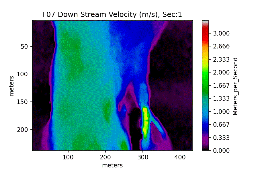
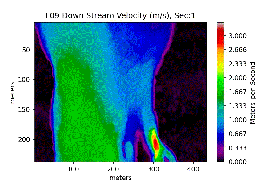
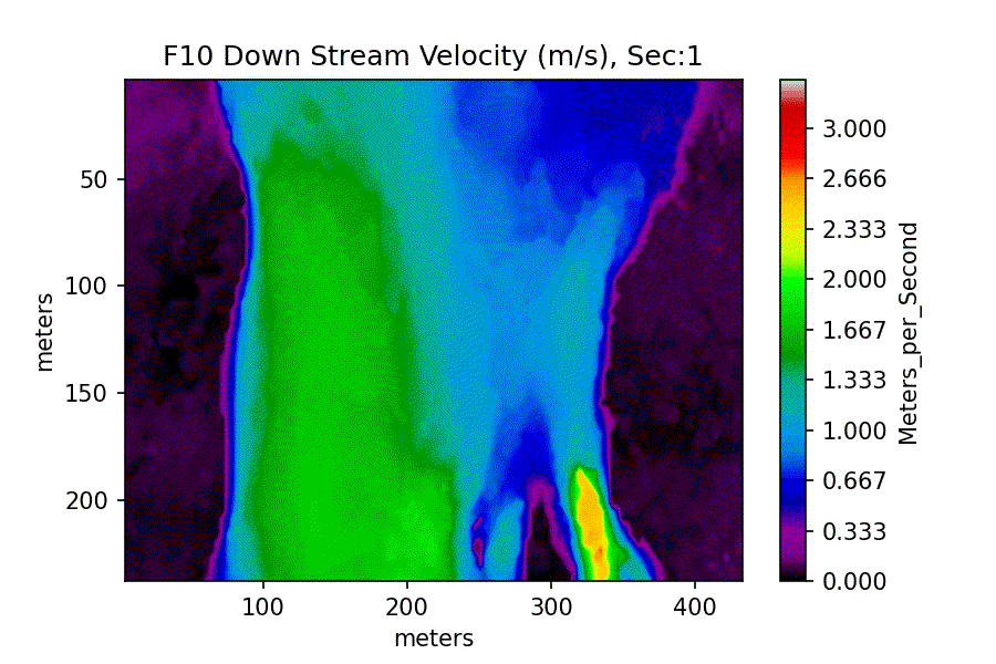
Stills from each Flight:


Flight 7
Flight 8

Flight 9

Flight 10
Velocity GIFs: